Can I say it again, Wow, this has been such a fabulous summer, Ryan and I did a wonderful backpacking trip on the Olympic Peninsula. We hiked out to the Tubal Cain Mine on the Tubal Cain Trail. This is an easy 3 miles out on a relatively flat hike. The hardest part was a little detour we did to see the wreck of a B17 aircraft. Up the Tull Canyon trail....straight up for only .7 of a mile, but it was straight up!!
 |
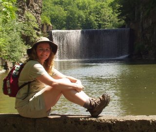
| Ready for adventure |
 |
| This is the Silver Creek shelter, just a few feet from the Trailhead |
 |
| The first creek crossing, high and dry |
 |
| This bridge doesn't look that great, luckily there was a new one just a few feet away |
 |
| Creek crossing on old mine equipment |
 |
| The mossy creeks were just lovely |
 |
| Mine shaft near the Tull Canyon trail |
 |
| From inside the mineshaft, looking out |
 |
| I brought fixings for chicken tacos! |
 |
| Ryan gives the tacos two thumbs up |
 |
| Hurrah, blueberries for dessert |
 |
| The deer feeding on the blueberries around our campsite |
 |
| It doesn't look that bad in the photo, but that is straight up |
 |
| Debris from the wrecked B17 covers this canyon area and is sometimes hidden by the overgrowth |
 |
| It doesn't look 60 years old |
 |
| this section was at a campsite |
 |
| part of an engine |
 |
| folks have used parts of the Airplane wreck for their campsites |
. We'd like to thank Steve B. for his donation this past week!
I hiked 8 miles and Ryan did about 18 miles. He made a loop by hiking up to Marmot Pass and back down to the Upper Dungeness Trailhead. I hiked out the way we came in (much flatter) and drove over to pick him up!
Follow this
link and help me help Washington State Trails. I have promised a bottle of wine to the person who donates the most money this August!!
If you don't like sending money over the internet, you can always send
me a check (made out to Washington Trails Association -WTA) or cash to Amanda Arkebauer PO Box 16131 Seattle, WA 98116


No comments:
Post a Comment